سایمونز تاون
سایمونز تاون (به لاتین: Simon's Town) یک شهرک در آفریقای جنوبی است که در کیپ غربی واقع شدهاست.[3]
سایمونز تاون Simonstad | |
|---|---|
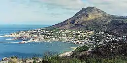 View of Simon's Town | |
| خطای لوآ در پودمان:Location_map در خط 543: Unable to find the specified location map definition: "Module:Location map/data/کیپ W" does not exist. | |
| مختصات: ۳۴°۱۱′۳۶″ جنوبی ۱۸°۲۶′۰۰″ شرقی | |
| کشور | آفریقای جنوبی |
| استان | کیپ غربی |
| ناحیه | City of Cape Town |
| Established | ۱۶۸۰[1] |
| وجه تسمیه | Simon van der Stel |
| مدیریت | |
| • Councillor | Simon Liell-Cock (DA) |
| مساحت | |
| • کل | ۱۹٫۸۱ کیلومتر مربع (۷٫۶ مایل مربع) |
| جمعیت (2011)[2] | |
| • کل | ۶٬۵۶۹ |
| • تراکم | ۳۳۰/کیلومتر مربع (۸۶۰/مایل مربع) |
| درصد نژادی (۲۰۱۱) | |
| • Black African | 24.5% |
| • رنگینپوستان | 12.7% |
| • Indian/Asian | 4.4% |
| • White | 56.4% |
| • Other | 2.0% |
| زبان نخست (۲۰۱۱) | |
| • انگلیسی | 68.0% |
| • آفریکانس | 18.5% |
| • خوسایی | 3.6% |
| • زولو | 2.4% |
| • Other | 7.5% |
نگارخانه
_p046_VIEW_OF_SIMONS_BAY.jpg.webp) Simon's Bay - Naval Base, 1806
Simon's Bay - Naval Base, 1806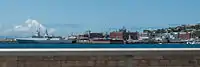 The South African Naval Base in Simon's Town.
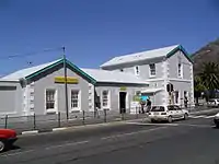 Simon's Town station
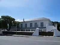 Admiralty House
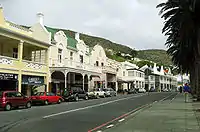 The historical centre of Simon's Town
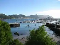 View of the harbour with the civilian yacht moorings in the foreground and the naval base to the right in the background.
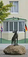 Statue of Just Nuisance in Simon's Town
جستارهای وابسته
منابع
- Robson, Linda Gillian (6 September 2011). "Annexure A [Chronological order of town establishment in South Africa...]". The Royal Engineers and Settlement Planning in the Cape Colony 1806–1872: Approach, Methodology and Impact (PDF) (Ph.D.). University of Pretoria. p. xlv. Retrieved 24 June 2012.
- "Main Place سایمونز تاون". Census 2011.
- مشارکت کنندگان ویکیپدیای انگلیسی. «Simon's Town».
This article is issued from Wikipedia. The text is licensed under Creative Commons - Attribution - Sharealike. Additional terms may apply for the media files.