سن-ادوارد، کبک
سن-ادوارد (به فرانسوی: Saint-Édouard) شهری در منطقه شهری له ژاردن-دو-ناپیرویل ناحیه مونترژی در استان کبک کانادا است. در سرشماری سال ۲۰۱۱ این شهر ۱٬۲۲۶ نفر جمعیت داشتهاست و مساحت آن ۵۲٫۹۱ کیلومتر مربع است.[6]
Saint-Édouard | |
|---|---|
شهرداری | |
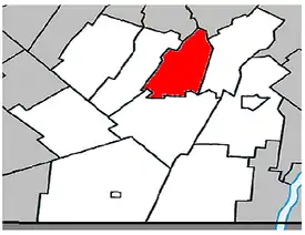 Location within Les Jardins-de-Napierville Regional County Municipality. | |
 Saint-Édouard | |
| مختصات (405C, montée Lussier[1]): ۴۵°۱۴′۲۲″ شمالی ۷۳°۳۰′۴۳″ غربی[2] | |
| کشور | |
| استان | |
| ناحیه | مونترژی |
| منطقه شهری | له ژاردن-دو-ناپیرویل |
| Constituted | July 1, 1855 |
| مدیریت | |
| • شهردار | Michel Raymond |
| • Federal riding | Beauharnois—Salaberry |
| • Prov. riding | Huntingdon |
| مساحت | |
| • کل | ۵۲٫۷۰ کیلومتر مربع (۲۰ مایل مربع) |
| • خشکی | ۵۲٫۹۳ کیلومتر مربع (۲۰ مایل مربع) |
| There is an apparent contradiction between two authoritative sources | |
| جمعیت | |
| • کل | ۱٬۳۱۲ |
| • تراکم | ۲۴٫۸/کیلومتر مربع (۶۴/مایل مربع) |
| • Change (2006–11) | ▲۸٫۳% |
| • Dwellings | ۵۳۶ |
| منطقه زمانی | یوتیسی −۵ (EST) |
| • تابستان (ساعت تابستانی) | یوتیسی −۴ (EDT) |
| Postal code(s) | J0L 1Y0 |
| پیششماره(های) تلفن | 450 and 579 |
| Access Routes[5] A-15 | Route 221 |
جستارهای وابسته
منابع
- «Ministère des Affaires municipales, des Régions et de l'Occupation du territoire: Saint-Édouard». بایگانیشده از اصلی در ۲۷ فوریه ۲۰۱۴. دریافتشده در ۱۹ فوریه ۲۰۱۳.
- Reference number 56138 of the Commission de toponymie du Québec (فرانسوی)
- Parliament of Canada Federal Riding History: BEAUHARNOIS--SALABERRY (Quebec)
- 2011 Statistics Canada Census Profile: Saint-Édouard, Quebec
- «Official Transport Quebec Road Map». بایگانیشده از اصلی در ۲۴ فوریه ۲۰۱۱. دریافتشده در ۱۹ فوریه ۲۰۱۳.
- "www.mamrot.gouv.qc.ca". اداره آمار کانادا. Archived from the original on 8 October 2014. Retrieved 6 Jan 2013.
| شهرها | |
|---|---|
| شهرداریها | |
| پریشها | |
| قصبهها | |
| Villages | |
| |
This article is issued from Wikipedia. The text is licensed under Creative Commons - Attribution - Sharealike. Additional terms may apply for the media files.