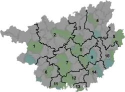
ناحیه یانگنینگ
یانگنینگ (به لاتین: Yongning District) یک سکونتگاه مسکونی در جمهوری خلق چین است که در ناننینگ واقع شدهاست.[4]
یانگنینگ 邕宁区 · Yunghningz Gih | |
|---|---|
District | |
| یانگنینگ | |
 Yongning Location in Guangxi | |
| مختصات: ۲۲°۴۴′۵۶″شمالی ۱۰۸°۲۹′۴۱″شرقی[1] | |
| کشور | People's Republic of China |
| Autonomous region | گوانگشی |
| شهر مرکزی | ناننینگ |
| مساحت | |
| • کل | ۱۲۵۵ کیلومتر مربع (۴۸۰ مایل مربع) |
| جمعیت (۲۰۱۰)[3] | |
| • کل | ۲۵۹۷۲۱ |
| • تراکم | ۲۱۰/کیلومتر مربع (۵۴۰/مایل مربع) |
| منطقه زمانی | یوتیسی +۸ (China Standard) |
| وبگاه | |
خصوصیات
یانگنینگ ۱٬۲۵۵ کیلومترمربع مساحت و ۲۵۹٬۷۲۱ نفر جمعیت دارد.
جستارهای وابسته
- فهرست شهرهای جمهوری خلق چین
منابع
- Google Inc. "Pumiaozhen". Google Maps (Map). Cartography by Google, Inc. https://www.google.com/maps/place/Pumiaozhen,+Yongning,+Nanning,+Guangxi,+China/@22.7488726,108.494679,15z/data=!3m1!4b1!4m2!3m1!1s0x36b3c16134c85063:0xcfc26565b009d02f. Retrieved 2014-07-02.
- Nanning City Land Use Plan (2006–20)/چینی ساده: 《南宁市土地利用总体规划(2006-2020年)》.(چینی) Accessed 8 July 2014.
- 《中国2010年人口普查分县资料》 (به چینی). چینی ساده: 中国统计出版社. December 2012. ISBN 978-7-5037-6659-6.
|access-date=requires|url=(help) - مشارکت کنندگان ویکیپدیای انگلیسی. «Yongning District».
This article is issued from Wikipedia. The text is licensed under Creative Commons - Attribution - Sharealike. Additional terms may apply for the media files.