امپاتوان، مگویندانائو
امپاتوان، مگویندانائو (به لاتین: Ampatuan, Maguindanao) یک سکونتگاه مسکونی در فیلیپین است که در ماگوئیندانائو واقع شدهاست.[1]
Ampatuan | |
|---|---|
Municipality | |
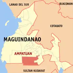 Map of ماگوئیندانائو showing the location of Ampatuan | |
| خطای لوآ در پودمان:Location_map در خط 543: Unable to find the specified location map definition: "Module:Location map/data/فیلیپین" does not exist. | |
| مختصات: ۶°۵۲′۱″ شمالی ۱۲۴°۲۸′۱″ شرقی | |
| کشور | |
| Region | Autonomous Region in Muslim Mindanao (ARMM) |
| استانهای فیلیپین | ماگوئیندانائو |
| Barangays | 11 |
| مدیریت | |
| • شهردار | Datu Rasul Sangki |
| مساحت | |
| • کل | ۲۵۵٫۴۰ کیلومتر مربع (۹۹ مایل مربع) |
| جمعیت (2010) | |
| • کل | ۱۷٬۸۰۰ |
| منطقه زمانی | یوتیسی +۸ (PST) |
| ZIP code | 9609 |
| Dialing code | 64 |
| Income class | 4th |
خصوصیات
امپاتوان ۲۵۵٫۴۰ کیلومترمربع مساحت و ۱۷٬۸۰۰ نفر جمعیت دارد.
جستارهای وابسته
منابع
- مشارکت کنندگان ویکیپدیای انگلیسی. «Ampatuan, Maguindanao».
This article is issued from Wikipedia. The text is licensed under Creative Commons - Attribution - Sharealike. Additional terms may apply for the media files.