بوفالو گپ، داکوتای جنوبی
بوفالو گپ(به انگلیسی: Buffalo Gap) شهری در ایالت داکوتای جنوبی کشور ایالات متحده آمریکا است که جمعیت آن در سرشماری سال ۲۰۱۰ میلادی، ۱۲۶ نفر بودهاست.[6]
Buffalo Gap | |
|---|---|
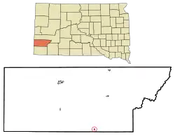 Location in Custer County and the state of داکوتای جنوبی | |
| مختصات: ۴۳°۲۹′۳۳″ شمالی ۱۰۳°۱۸′۵۱″ غربی | |
| کشور | ایالات متحده آمریکا |
| State | داکوتای جنوبی |
| شهرستان | Custer |
| مساحت | |
| • کل | ۰٫۳۱ مایل مربع (۰٫۸۰ کیلومتر مربع) |
| • خشکی | ۰٫۳۱ مایل مربع (۰٫۸۰ کیلومتر مربع) |
| • آب | ۰ مایل مربع (۰ کیلومتر مربع) |
| بلندی | ۳۲۶۱ پا (۹۹۴ متر) |
| جمعیت | |
| • کل | ۱۲۶ |
| • برآورد (2011[3]) | ۱۲۸ |
| • تراکم | ۴۰۶٫۵/مایل مربع (۱۵۷٫۰/کیلومتر مربع) |
| منطقه زمانی | یوتیسی -۷ (MST) |
| • تابستان (ساعت تابستانی) | یوتیسی -۶ (MDT) |
| Zip Code | 57722 |
| پیششماره(های) تلفن | 605 |
| FIPS code | 46-08340[4] |
| GNIS feature ID | 1254122[5] |
جستارهای وابسته
منابع
- "US Gazetteer files 2010". United States Census Bureau. Archived from the original on 14 July 2012. Retrieved 2012-06-21.
- "American FactFinder". United States Census Bureau. Retrieved 2012-06-21.
- "Population Estimates". United States Census Bureau. Archived from the original on 18 September 2012. Retrieved 2013-01-05. External link in
|publisher=(help) - "American FactFinder". اداره آمار آمریکا. Retrieved 2008-01-31.
- "US Board on Geographic Names". سازمان نقشهبرداریهای زمینشناسی آمریکا. 2007-10-25. Retrieved 2008-01-31.
- "United States of America: largest cities and towns and statistics of their population". world-gazetteer. Retrieved 29 Jan 2013.
This article is issued from Wikipedia. The text is licensed under Creative Commons - Attribution - Sharealike. Additional terms may apply for the media files.