توئی، آیچی
توئی، آیچی (به لاتین: Tōei, Aichi) یک سکونتگاه مسکونی در Japan است که در Kitashitara District, Aichi واقع شدهاست.[1]
Tōei 東栄町 | |
|---|---|
شهر | |
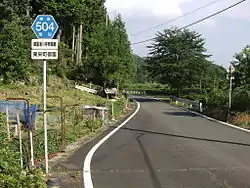 Aichi Prefectural Route 504 in Misono | |
 پرچم  نشان | |
 Location of Tōei in استان آیچی | |
 Tōei | |
| مختصات: ۳۵°۵′ شمالی ۱۳۷°۴۲′ شرقی | |
| کشور | Japan |
| Region | Chūbu region Tōkai region |
| Prefectures of Japan | Aichi Prefecture |
| District | Kitashitara |
| مساحت | |
| • کل | ۱۲۳٫۴۰ کیلومتر مربع (۴۸ مایل مربع) |
| جمعیت (February 2012) | |
| • کل | ۳٬۶۵۴ |
| • تراکم | ۲۹٫۶/کیلومتر مربع (۷۷/مایل مربع) |
| منطقه زمانی | یوتیسی +۹ (Japan Standard Time) |
| - Tree | کریپتومریا |
| - Flower | Lilium auratum |
| - Bird | Japanese bush warbler |
| Phone number | 0536-76-0501 |
| Address | Hongo, Tōei-mura, Kitashitara-gun, Aichi-ken 449-0292 |
| وبگاه | |
خصوصیات
توئی ۱۲۳٫۴۰ کیلومترمربع مساحت و ۳٬۶۵۴ نفر جمعیت دارد.
جستارهای وابسته
منابع
- مشارکت کنندگان ویکیپدیای انگلیسی. «Tōei, Aichi».
ناگویا (capital) | ||
| Core cities | ||
| Special cities | ||
| Cities | ||
| بخش آیچی | ||
| بخش آما | ||
| بخش چیتا | ||
| بخش کیتاشیتارا | ||
| بخش نیشیکاتسوگی | ||
| بخش نیوا | ||
| بخش نوکاتا | ||
فهرست ادغام در استان آیچی | ||
This article is issued from Wikipedia. The text is licensed under Creative Commons - Attribution - Sharealike. Additional terms may apply for the media files.