شهرستان براشوو
شهرستان براشوو (به لاتین: Brașov County) یک județ در رومانی است که در رومانی واقع شدهاست.[2]
Brașov County Județul Brașov | |
|---|---|
کانتی | |
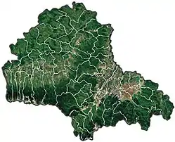
 Administrative map | |
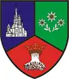
 نشان | |
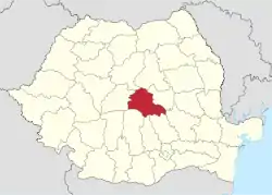
 Location of Brașov County in Romania | |
| مختصات: ۴۵٫۷۹°شمالی ۲۵٫۲۸°شرقی | |
| کشور | |
| Development region1 | Centru |
| Historic region | ترانسیلوانی |
| Capital city (Reședință de județ) | براشوف |
| مدیریت | |
| • نوع | County Board |
| • President of the County Board | Aristotel Căncescu (National Liberal Party) |
| • Prefect2 | Adriana Donțu |
| مساحت | |
| • کل | ۵۳۶۳ کیلومتر مربع (۲۱۰۰ مایل مربع) |
| رتبه مساحت | 25th in Romania |
| جمعیت (2011 census[1]) | |
| • کل | ۵۴۹٬۲۱۷ |
| • رتبه | 13th in Romania |
| • تراکم | ۱۰۰/کیلومتر مربع (۲۷۰/مایل مربع) |
| منطقه زمانی | یوتیسی +۲ (EET) |
| • تابستان (ساعت تابستانی) | یوتیسی +۳ (EEST) |
| Postal Code | 50wxyz3 |
| پیششماره(های) تلفن | +40 x684 |
| Car Plates | BV5 |
| تولید ناخالص داخلی | US$ 6.63 billion (2008) |
| تولید ناخالص داخلی/کپیتا گروپ | US$ 11,262 (2008) |
| وبگاه | |
| 1The developing regions of رومانی have no administrative role. They were formed just to attract funds from the اتحادیه اروپا 2 as of 2007, the Prefect is not a politician, but a public functionary. He (or she) is not allowed to be a member of a political party, and is banned to have any political activity in the first six months after the resignation (or exclusion) from the public functionary corps 3w, x, y, and z are digits that indicate the city, the street, part of the street, or even the building of the address 4x is a digit indicating the operator: 2 for the former national operator, رومتلکام، and 3 for the other ground telephone networks 5used on both the plates of the vehicles that operate only in the county limits (like utility vehicles, خودروی همهجارو، etc.), and the ones used outside the county | |
خصوصیات
شهرستان براشوو ۵٬۳۶۳ کیلومترمربع مساحت و ۵۴۹٬۲۱۷ نفر جمعیت دارد.
جستارهای وابسته
منابع
- "Population at 20 October 2011" (به Romanian). INSSE. 5 July 2013. Retrieved 9 July 2013.
- مشارکت کنندگان ویکیپدیای انگلیسی. «Brașov County».
This article is issued from Wikipedia. The text is licensed under Creative Commons - Attribution - Sharealike. Additional terms may apply for the media files.