ماچیلیپاتنام
ماچیلیپاتنام (به انگلیسی: Machilipatnam) یک شهر در هند است که در Krishna district واقع شدهاست.[3] ماچیلیپاتنام ۲۶٫۶۷ کیلومتر مربع مساحت و ۱۶۹٬۸۹۲ نفر جمعیت دارد و ۱۴ متر بالاتر از سطح دریا واقع شدهاست.
ماچیلیپاتنام Masulipatnam, Masula, Bandar | |
|---|---|
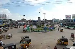 Koneru centre, the business centre of Machilipatnam | |
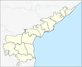 ماچیلیپاتنام Location in Andhra Pradesh, India  ماچیلیپاتنام ماچیلیپاتنام (هند) | |
| مختصات: ۱۶٫۱۷°شمالی ۸۱٫۱۳°شرقی | |
| کشور | هند |
| ایالت | آندرا پرادش |
| District | Krishna |
| Mandal | Machilipatnam |
| تأسیسشده | 14th century |
| مدیریت | |
| • نوع | Mayor council |
| • هیئت حاکمه | Machilipatnam Municipal Corporation |
| • MLA | Kollu Ravindra (حزب تلوگو دسام) |
| • Municipal commissioner | A.S.N.V.Maruthi Diwakar |
| مساحت | |
| • کل | ۲۶٫۶۷ کیلومتر مربع (۱۰ مایل مربع) |
| بلندی | ۱۴ متر (۴۶ پا) |
| جمعیت (۲۰۱۱)[2] | |
| • کل | ۱۶۹۸۹۲ |
| • تراکم | ۶۸۷۵/کیلومتر مربع (۱۷۸۱۰/مایل مربع) |
| زبانها | |
| • رسمی | زبان تلوگو |
| منطقه زمانی | یوتیسی +۵:۳۰ (IST) |
| PIN | 521 xxx |
| کد تلفن | ۹۱–۸۶۷۲ |
| پلاک خودرو | AP-16 |
| وبگاه | |
جستارهای وابسته
منابع
- "Machilipatnam at Glance". Machilipatnam Municipality. Archived from the original on 9 January 2016. Retrieved 12 May 2015.
- "Andhra Pradesh (India): Districts, Cities, Towns and Outgrowth Wards – Population Statistics in Maps and Charts". citypopulation.de.
- مشارکتکنندگان ویکیپدیا. «Machilipatnam». در دانشنامهٔ ویکیپدیای انگلیسی.
This article is issued from Wikipedia. The text is licensed under Creative Commons - Attribution - Sharealike. Additional terms may apply for the media files.