پرت دیپازیت، مریلند
پرت دیپازیت (به انگلیسی: Port Deposit) شهری در ایالت مریلند کشور ایالات متحده آمریکا است که جمعیت آن در سرشماری سال ۲۰۱۰ میلادی، ۶۵۳ نفر بودهاست.[4]
Port Deposit, Maryland | |
|---|---|
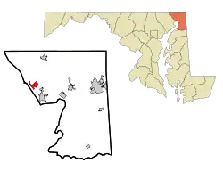 Location of Port Deposit, Maryland | |
| مختصات: ۳۹°۳۶′۳۹″ شمالی ۷۶°۶′۱″ غربی | |
| کشور | آمریکا |
| ایالت | مریلند |
| شهرستان | Cecil |
| مساحت | |
| • کل | ۲٫۲۸ مایل مربع (۵٫۹۱ کیلومتر مربع) |
| • خشکی | ۲٫۲۷ مایل مربع (۵٫۸۸ کیلومتر مربع) |
| • آب | ۰٫۰۱ مایل مربع (۰٫۰۳ کیلومتر مربع) |
| بلندی | ۴۹ پا (۱۵ متر) |
| جمعیت (۲۰۱۰) | |
| • کل | ۶۵۳ |
| • برآورد (۲۰۱۱[2]) | ۶۵۷ |
| • تراکم | ۲۸۷٫۷/مایل مربع (۱۱۱٫۱/کیلومتر مربع) |
| منطقه زمانی | یوتیسی -۵ (Eastern (EST)) |
| • تابستان (ساعت تابستانی) | یوتیسی -۴ (EDT) |
| زیپکد | ۲۱۹۰۴ |
| پیششماره(های) تلفن | ۴۱۰ |
| FIPS کد | ۲۴-۶۳۰۷۵ |
| GNIS feature ID | ۰۵۹۱۰۴۹ |
Port Deposit | |
U.S. Historic District | |
 | |
| موقعیت | E bank of Susquehanna River 10 mi. (16 km) S of Mason-Dixon Line, Port Deposit, Maryland |
| مساحت | ۲۸۰ جریب فرنگی (۱۱۳٫۳ هکتار) |
| سبک معماری | Second Empire, Queen Anne, Georgian |
| منبع NRHP | ۷۸۰۰۱۴۵۲[3] |
| اضافه شده به NRHP | May 23, 1978 |
جستارهای وابسته
منابع
- "US Gazetteer files 2010". United States Census Bureau. Archived from the original on 14 July 2012. Retrieved 2013-01-25.
- "Population Estimates". United States Census Bureau. Archived from the original on 18 September 2012. Retrieved 2013-01-25. External link in
|publisher=(help) - سازمان پارکهای ملی (2010-07-09). "National Register Information System". National Register of Historic Places. National Park Service.
- "Maryland". factfinder2.census.gov. Retrieved 29 Jan 2013.
| موضوعات |
|
|---|---|
| جامعه | |
| مناطق |
|
| شهرها | |
| شهرکها | |
| CDPs |
|
| شهرستانها | |
This article is issued from Wikipedia. The text is licensed under Creative Commons - Attribution - Sharealike. Additional terms may apply for the media files.