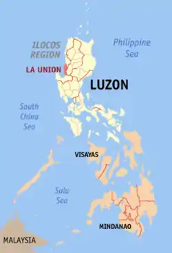
لا یونیون
لا یونیون، پرو (به لاتین: La Union) یک استانهای فیلیپین در فیلیپین است که در Ilocos Region واقع شدهاست. [3]
لا یونیون، پرو | |
|---|---|
 Welcome Arch of La Union at the La Union-Ilocos Sur border | |
 پرچم  مهر | |
 موقعیت لا یونیون، پرو در نقشه | |
| مختصات: ۱۶°۳۰′ شمالی ۱۲۰°۲۵′ شرقی | |
| کشور | |
| Region | Region I |
| تأسیسشده | ۲ مارس ۱۸۵۰ |
| پایتخت | San Fernando City |
| مدیریت | |
| • فرماندار | Manuel "Manoling" C. Ortega (NPC) |
| • Vice Governor | Aureo Nisce (NPC) |
| مساحت | |
| • کل | ۱۴۹۷٫۷۰ کیلومتر مربع (۵۸۰ مایل مربع) |
| رتبه مساحت | 68th out of 80 |
| جمعیت (2010)[2] | |
| • کل | ۷۴۱٬۹۰۶ |
| • رتبه | 37th out of 80 |
| • تراکم | ۵۰۰/کیلومتر مربع (۱۳۰۰/مایل مربع) |
| • رتبه تراکم | 10th out of 80 |
| Divisions | |
| • Independent cities | 0 |
| • Component cities | 1 |
| • Municipalities | 19 |
| • Barangay | 576 |
| • Districts | 1st and 2nd districts of La Union |
| منطقه زمانی | یوتیسی +۸ (PHT) |
| ZIP code | 2500 – 2520 |
| Dialing code | 72 |
| زبانها | زبان ایلوکانو , زبان پانگاسینانی، Kankanaey، Ibaloi، زبان تاگالوگ، زبان انگلیسی |
| وبگاه | |
خصوصیات
لا یونیون ۱٬۴۹۷٫۷۰ کیلومترمربع مساحت و ۷۴۱٬۹۰۶ نفر جمعیت دارد.
جستارهای وابسته
منابع
- "List of Provinces". PSGC Interactive. Makati City, Philippines: National Statistical Coordination Board. Retrieved 30 July 2013.
- "Population and Annual Growth Rates for The Philippines and Its Regions, Provinces, and Highly Urbanized Cities" (PDF). 2010 Census and Housing Population. National Statistics Office. Retrieved 30 July 2013.
- مشارکت کنندگان ویکیپدیای انگلیسی. «La Union».
This article is issued from Wikipedia. The text is licensed under Creative Commons - Attribution - Sharealike. Additional terms may apply for the media files.