گارتسون، داکوتای جنوبی
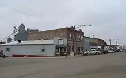
گارتسون(به انگلیسی: Garretson) شهری در ایالت داکوتای جنوبی کشور ایالات متحده آمریکا است که جمعیت آن در سرشماری سال ۲۰۱۰ میلادی، ۱٬۱۶۶ نفر بودهاست.[7]
Garretson, South Dakota | |
|---|---|
 | |
| لقب(ها): The City of Parks | |
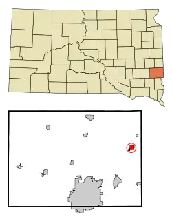 Location in Minnehaha County and the state of داکوتای جنوبی | |
| مختصات: ۴۳°۴۲′۵۲″ شمالی ۹۶°۳۰′۷″ غربی | |
| کشور | ایالات متحده آمریکا |
| State | داکوتای جنوبی |
| شهرستان | Minnehaha |
| Incorporated | 1891[1] |
| مدیریت | |
| • Mayor | Tim Mullen |
| مساحت | |
| • کل | ۱٫۴۹ مایل مربع (۳٫۸۶ کیلومتر مربع) |
| • خشکی | ۱٫۴۵ مایل مربع (۳٫۷۶ کیلومتر مربع) |
| • آب | ۰٫۰۴ مایل مربع (۰٫۱۰ کیلومتر مربع) |
| بلندی | ۱۵۰۳ پا (۴۵۸ متر) |
| جمعیت | |
| • کل | ۱٬۱۶۶ |
| • برآورد (2011[4]) | ۱٬۱۸۲ |
| • تراکم | ۸۰۴٫۱/مایل مربع (۳۱۰٫۵/کیلومتر مربع) |
| منطقه زمانی | یوتیسی -۶ (Central (CST)) |
| • تابستان (ساعت تابستانی) | یوتیسی -۵ (CDT) |
| زیپکد | 57030 |
| پیششماره(های) تلفن | 605 |
| FIPS code | 46-23820[5] |
| GNIS feature ID | 1255211[6] |
| وبگاه | |
جستارهای وابسته
منابع
- "SD Towns" (PDF). South Dakota State Historical Society. Retrieved 2010-02-12.
- "US Gazetteer files 2010". United States Census Bureau. Archived from the original on 14 July 2012. Retrieved 2012-06-21.
- "American FactFinder". United States Census Bureau. Retrieved 2012-06-21.
- "Population Estimates". United States Census Bureau. Archived from the original on 18 September 2012. Retrieved 2013-01-05. External link in
|publisher=(help) - "American FactFinder". اداره آمار آمریکا. Retrieved 2008-01-31.
- "US Board on Geographic Names". سازمان نقشهبرداریهای زمینشناسی آمریکا. 2007-10-25. Retrieved 2008-01-31.
- "United States of America: largest cities and towns and statistics of their population". world-gazetteer. Retrieved 29 Jan 2013.
شهرداریها و جوامع شهرستان مینههاها، داکوتای جنوبی، ایالات متحده | ||
|---|---|---|
| شهرها | 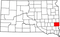 | |
| شهرک | ||
| سیدیپیها | ||
| محدوده ثبتنشده |
| |
| تاونشیپها |
| |
| پانویسها | ‡قسمتهایی از این منطقه مسکونی در شهرستانهای اطراف قرار دارد | |
This article is issued from Wikipedia. The text is licensed under Creative Commons - Attribution - Sharealike. Additional terms may apply for the media files.